Grand Traverse Bay Stone Circle and Mastodon Petroglyph
Discovery Parameters
Discovery Year
2007
Depth
40 feet
Key Feature
Mile-long linear alignment
Anomalous Object
Purported Mastodon Petroglyph
Interpretive Support
Glacial/Geological Emplacement
5
Prehistoric Hunting Structure
3
Confirmed Mastodon Petroglyph
1
Stonehenge-like Henge
1
Discovery Timeline
| Event | What is documented::Source basis |
|---|---|
| Summer 2007 | Holley’s team was mapping the preserve when the discovery sequence began.::WBEZ archive and Chicago Tribune reprint. |
| June 2007 | Divers found the boulder with mastodon-like markings at about 40 feet depth.::AP reprint. |
| Early 2009 | Reporting broadened from the boulder to a larger underwater stone pattern in Grand Traverse Bay.::Chicago Tribune reprint. |
| Holley’s later public summary | Holley rejected the 'Stonehenge' label and described the site instead as a long line of stones over a mile long.::Holley’s website. |
Scope and source base
This report is grounded in Holley’s own public materials, contemporaneous 2007–2009 reporting, a 2017 scholarly review of purported proboscidean rock art, official Great Lakes geology references, and the peer-reviewed Lake Huron comparison case that Holley himself cites as the closest published analogue. [1]Source 1 https://holleyarchaeology.com/index.php/the-truth-about-the-stonehenge-in-lake-michigan/, [5]Source 5 https://www.historynewsnetwork.org/article/possible-mastodon-carving-found-on-rock-in-lake-mi, [10]Source 10 https://repository.library.noaa.gov/view/noaa/31460/noaa_31460_DS1.pdf, [16]Source 16 https://encyclopedia.pub/entry/2890, [25]Source entry missing for citation [25], [26]Source entry missing for citation [26]
Mark Holley taught underwater archaeology at Northwestern Michigan College and served as chief archaeologist of the Grand Traverse Bay Underwater Preserve, which is the institutional context for the 2007 discovery. [2]Source 2 https://nasnmc.com/dr-mark-w-holley/, [4]Source 4 https://www.wbez.org/eight-forty-eight/2009/01/15/underwater-archaeologist-works-to-prove-petroglyph
I also reviewed a 2025 Jerusalem Post story about supposed new sonar confirmation, but I give it low evidentiary weight here because the article states that it was “written with the help of a news-analysis system” and its text points readers to secondary outlets, not to a released technical report or peer-reviewed publication. [3]Source 3 https://www.jpost.com/archaeology/article-860220
The most important methodological point is that the Grand Traverse Bay site has not been published in the kind of detailed peer-reviewed form that exists for the Lake Huron hunting complex, so the available public record is much thinner and much more interpretive. [25]Source entry missing for citation [25], [26]Source entry missing for citation [26]
What is securely documented about the discovery
Holley’s team was mapping the Grand Traverse Bay Underwater Preserve in 2007 when the discovery sequence began. [4]Source 4 https://www.wbez.org/eight-forty-eight/2009/01/15/underwater-archaeologist-works-to-prove-petroglyph, [5]Source 5 https://www.historynewsnetwork.org/article/possible-mastodon-carving-found-on-rock-in-lake-mi
The first publicized object was a granite boulder found in June 2007 at about 40 feet depth while the team was searching for shipwrecks, and divers said its markings resembled a mastodon with what might be a spear in its side. [5]Source 5 https://www.historynewsnetwork.org/article/possible-mastodon-carving-found-on-rock-in-lake-mi
Holley was cautious at the outset, saying that the apparent image needed expert verification before anyone could say it was genuinely carved. [5]Source 5 https://www.historynewsnetwork.org/article/possible-mastodon-carving-found-on-rock-in-lake-mi
By early 2009, broader reporting described a pattern of stones on an otherwise sandy stretch of lake floor in Grand Traverse Bay, also at about 40 feet depth, and said Holley had found the site accidentally during 2007 lake-bottom survey work. [5]Source 5 https://www.historynewsnetwork.org/article/possible-mastodon-carving-found-on-rock-in-lake-mi
That 2009 coverage also said the exact location was being kept secret because of American Indian concerns that the area could be sacred and to limit disturbance to the site. [5]Source 5 https://www.historynewsnetwork.org/article/possible-mastodon-carving-found-on-rock-in-lake-mi
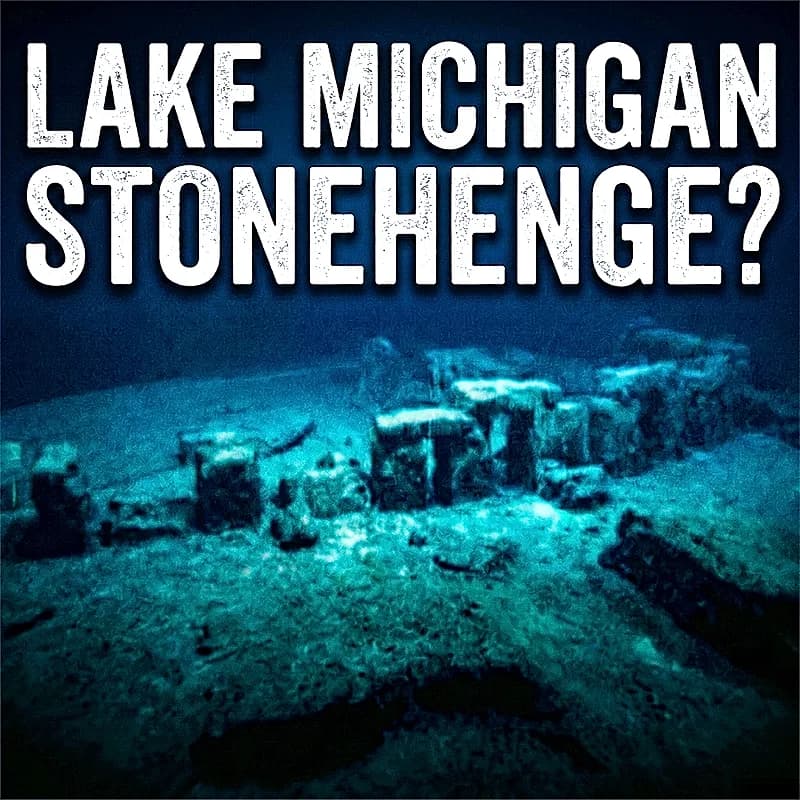
Holley’s own later public explanation explicitly rejects the label “Stonehenge,” saying that there is “not a henge associated with the site” and that the find is “best described as a long line of stones which is over a mile in length.” [1]Source 1 https://holleyarchaeology.com/index.php/the-truth-about-the-stonehenge-in-lake-michigan/, [8]Source 8 https://www.bldgblog.com/tag/mark-holley/
At the same time, later popular summaries quoting Holley describe a smaller circular component within that broader alignment, with an outer ring of about 40 feet and an inner ring of about 20 feet. [11]Source 11 https://repository.library.noaa.gov/view/noaa/31460
That mixed description is important because the public story has often collapsed two different scales of evidence into one image: a mile-scale linear alignment in Holley’s wording, and a much smaller ring-like arrangement in later media retellings. [1]Source 1 https://holleyarchaeology.com/index.php/the-truth-about-the-stonehenge-in-lake-michigan/, [11]Source 11 https://repository.library.noaa.gov/view/noaa/31460
What the public sonar and dive record actually shows
Holley’s public page offers a sonar scan, a photo of the “rock of interest,” and an extract from a television program, but it does not itself present a technical monograph, a georeferenced site map, or a formal analytical report. [1]Source 1 https://holleyarchaeology.com/index.php/the-truth-about-the-stonehenge-in-lake-michigan/, [7]Source 7 https://news.artnet.com/art-world/prehistoric-structure-lake-michigan-stonehenge-2432737
The published sonar frame on Holley’s site is annotated as “40 feet deep” and “293 feet” across, and it marks numerous targets with white circles inside a circular field. [13]Source 13 https://www.nps.gov/articles/000/learn-look-petroglyphs-pictographs.htm
A 2009 write-up based on a Holley/Abbott expedition PDF reported that the survey used a Kongsberg-Mesotech MS 1000 sector scan sonar. [10]Source 10 https://repository.library.noaa.gov/view/noaa/31460/noaa_31460_DS1.pdf
Manufacturer documentation describes the MS1000 as a single-beam scanning sonar whose sector width can be adjusted up to 360°, and as a system that produces georeferenced images and supports annotation tools. [11]Source 11 https://repository.library.noaa.gov/view/noaa/31460, [12]Source 12 https://www.discovermagazine.com/archaeologists-have-found-prehistoric-rock-structures-under-the-great-lakes-42339
That means the circular frame shape of the published image should be read first as a property of the scan geometry and display, not as proof that the archaeological feature itself is a perfect giant circle. [11]Source 11 https://repository.library.noaa.gov/view/noaa/31460, [12]Source 12 https://www.discovermagazine.com/archaeologists-have-found-prehistoric-rock-structures-under-the-great-lakes-42339, [13]Source 13 https://www.nps.gov/articles/000/learn-look-petroglyphs-pictographs.htm
The strongest visual pattern in Holley’s published sonar still is not a continuous stone ring but a clustered, roughly linear chain of returns running through the central portion of the image. [13]Source 13 https://www.nps.gov/articles/000/learn-look-petroglyphs-pictographs.htm
In that sense, the public sonar image is actually quite consistent with Holley’s own phrase “a long line of stones” and less consistent with the popular impression of a compact, freestanding underwater henge. [13]Source 13 https://www.nps.gov/articles/000/learn-look-petroglyphs-pictographs.htm, [8]Source 8 https://www.bldgblog.com/tag/mark-holley/
A useful comparison comes from the peer-reviewed Lake Huron case, where O’Shea’s team explained that in their acoustic images the black central circle marks the scanning unit, red circles are simply radius guides, light objects are strong acoustic targets, and dark areas are acoustic shadows. [25]Source entry missing for citation [25]
By analogy, the red concentric circles on Holley’s public sonar image should be treated as display or interpretation aids, not as automatically resolved stone arcs. [13]Source 13 https://www.nps.gov/articles/000/learn-look-petroglyphs-pictographs.htm, [25]Source entry missing for citation [25]
The public dive imagery sends the same cautionary signal. [7]Source 7 https://news.artnet.com/art-world/prehistoric-structure-lake-michigan-stonehenge-2432737, [26]Source entry missing for citation [26]
Holley’s own underwater still shows low, rounded boulders set on a sandy bottom, not tall, isolated standing stones of the Stonehenge type. [7]Source 7 https://news.artnet.com/art-world/prehistoric-structure-lake-michigan-stonehenge-2432737
O’Shea, who has dived the Grand Traverse Bay site, said the shallow rocks there are covered in algae, sediment, and invasive mussels, which makes it hard to determine whether the stones are natural or intentionally arranged. [26]Source entry missing for citation [26]
That is an important difference from the published Lake Huron structures, where the deeper site preserved clearer context and where the investigators could combine acoustic mosaics, video, diver mapping, radiocarbon dates, and cultural artifacts into a stronger cumulative case. [25]Source entry missing for citation [25]
The mastodon boulder claim
The mastodon claim is older than the “Stonehenge” label and was the feature first publicized in 2007. [5]Source 5 https://www.historynewsnetwork.org/article/possible-mastodon-carving-found-on-rock-in-lake-mi
The contemporaneous AP report described the boulder as granite and said the markings looked like a mastodon with what might be a spear in its side. [5]Source 5 https://www.historynewsnetwork.org/article/possible-mastodon-carving-found-on-rock-in-lake-mi
Holley’s public photograph of the stone presents the claimed animal as a dark traced outline superimposed on the natural cracks and irregularities of the boulder’s surface. [9]Source 9 https://m-geo.ru/upload/iblock/361/ypml15sufh3bpr4bo1fs3w78n0rvif3c.pdf
That presentation style matters because traced outlines can make ambiguous natural linework look much more deliberate than it appears unenhanced. [9]Source 9 https://m-geo.ru/upload/iblock/361/ypml15sufh3bpr4bo1fs3w78n0rvif3c.pdf, [14]Source 14 https://www.nps.gov/articles/000/mammut_americanum.htm
The National Park Service describes petroglyphs as images made by carving, chipping, pecking, or grinding rock surfaces with tools. [16]Source 16 https://encyclopedia.pub/entry/2890
Rock-art science likewise emphasizes that researchers must distinguish humanly made marks from natural markings by examining physical traces of manufacture and by recording the full surface context, including fissures, weathering, and even glacial striae. [14]Source 14 https://www.nps.gov/articles/000/mammut_americanum.htm
The most focused scholarly discussion of the Grand Traverse boulder that I located is Ekkehart Malotki’s 2017 review of claimed mammoth and mastodon depictions in North American rock art. [18]Source 18 https://www.ngdc.noaa.gov/mgg/greatlakes/lakemich_cdrom/html/geomorph.htm
Malotki wrote that photographs of the boulder show numerous fissures that only suggest a mastodon-like animal when mentally grouped together, and he concluded that the lines appear to be completely natural with “no clear evidence of being human-made.” [18]Source 18 https://www.ngdc.noaa.gov/mgg/greatlakes/lakemich_cdrom/html/geomorph.htm
He further judged the image most likely to be a case of pareidolia, meaning the human tendency to perceive a recognizable figure in random marks. [18]Source 18 https://www.ngdc.noaa.gov/mgg/greatlakes/lakemich_cdrom/html/geomorph.htm
Malotki’s review also records Daniel Fisher’s skepticism after seeing photographs and says that, to Fisher’s knowledge at the time, mastodons were not known to have ranged into northern Michigan, although fossils were known from the southern part of the state. [18]Source 18 https://www.ngdc.noaa.gov/mgg/greatlakes/lakemich_cdrom/html/geomorph.htm
If the image were genuine, it would be an extraordinary claim because all of North America’s proboscideans were extinct by around 10,500 years ago, so a verified mastodon depiction in Michigan would imply a very early date and an unusually important piece of Paleoindian imagery. [19]Source 19 https://pubs.usgs.gov/publication/wri904122, [5]Source 5 https://www.historynewsnetwork.org/article/possible-mastodon-carving-found-on-rock-in-lake-mi
That is exactly why the boulder requires a very high evidentiary bar, and the public materials I reviewed do not clear that bar. [9]Source 9 https://m-geo.ru/upload/iblock/361/ypml15sufh3bpr4bo1fs3w78n0rvif3c.pdf, [16]Source 16 https://encyclopedia.pub/entry/2890, [14]Source 14 https://www.nps.gov/articles/000/mammut_americanum.htm, [18]Source 18 https://www.ngdc.noaa.gov/mgg/greatlakes/lakemich_cdrom/html/geomorph.htm
The geological alternative
The geological background of Grand Traverse Bay strongly favors caution before treating its boulders as built architecture. [20]Source 20 https://pubs.usgs.gov/of/2004/1216/text.html, [21]Source 21 https://www.dmr.nd.gov/dmr/ndgs/erratics
NOAA describes the bay and adjacent land as part of a ridge-and-valley topography shaped by glacial erosion, with thin glacial drift and lacustrine sediment cover over underlying Silurian and Devonian sedimentary rocks such as limestone and shale. [20]Source 20 https://pubs.usgs.gov/of/2004/1216/text.html
USGS says glacial deposits in Grand Traverse County include till, outwash, and lacustrine materials, and that these deposits can be very thick across the region. [21]Source 21 https://www.dmr.nd.gov/dmr/ndgs/erratics
That geological setting makes transferred boulders entirely unsurprising. [21]Source 21 https://www.dmr.nd.gov/dmr/ndgs/erratics, [22]Source entry missing for citation [22]
The National Park Service defines glacial erratics as rocks that glaciers pick up and transport over long distances before dropping them elsewhere. [22]Source entry missing for citation [22]
The North Dakota Geological Survey adds that large erratics are commonly granite or gneiss and can be car-sized. [23]Source entry missing for citation [23]
Because NOAA identifies the local bedrock under Grand Traverse Bay as mainly sedimentary, not granitic, a granite boulder on that lake floor is therefore highly compatible with the ordinary geology of glacial erratics. [20]Source 20 https://pubs.usgs.gov/of/2004/1216/text.html, [22]Source entry missing for citation [22], [23]Source entry missing for citation [23]
The groove-like markings on the boulder are also not geologically exotic. [24]Source entry missing for citation [24], [21]Source 21 https://www.dmr.nd.gov/dmr/ndgs/erratics
USGS defines glacial striations as multiple, generally parallel grooves carved by rocks frozen into the base of a glacier, and NPS says glaciers act like a coarse sandpaper that scratches rock surfaces and leaves striations behind. [24]Source entry missing for citation [24], [21]Source 21 https://www.dmr.nd.gov/dmr/ndgs/erratics
Holley himself said he hoped a computer model of the boulder would help experts decide whether the markings were a trick of chance produced by glacial forces or the work of ancient humans. [5]Source 5 https://www.historynewsnetwork.org/article/possible-mastodon-carving-found-on-rock-in-lake-mi
So the geological explanation is not a straw man invented by critics after the fact; it was one of the core alternatives recognized from the beginning. [5]Source 5 https://www.historynewsnetwork.org/article/possible-mastodon-carving-found-on-rock-in-lake-mi, [18]Source 18 https://www.ngdc.noaa.gov/mgg/greatlakes/lakemich_cdrom/html/geomorph.htm
On the accessible evidence, the geological reading is straightforward: glacially emplaced or reworked boulders in a glacially sculpted bay, plus natural fissures or groove-like marks on at least one granite erratic. [20]Source 20 https://pubs.usgs.gov/of/2004/1216/text.html, [21]Source 21 https://www.dmr.nd.gov/dmr/ndgs/erratics, [22]Source entry missing for citation [22], [24]Source entry missing for citation [24], [18]Source 18 https://www.ngdc.noaa.gov/mgg/greatlakes/lakemich_cdrom/html/geomorph.htm
Comparison with the authenticated Lake Huron case
The best reason the Grand Traverse Bay site cannot simply be dismissed out of hand is that there really is a peer-reviewed, 9,000-year-old, submerged stone hunting complex in the Great Lakes region. [25]Source entry missing for citation [25], [26]Source entry missing for citation [26]
O’Shea’s PNAS paper on the Alpena-Amberley Ridge in Lake Huron documents a dry land corridor during the Lake Stanley lowstand, with lake levels as much as 100 meters lower than present between 11,500 and 7,000 cal B.P. [25]Source entry missing for citation [25]
That team also had much stronger evidence than the Grand Traverse Bay public record currently provides. [25]Source entry missing for citation [25], [26]Source entry missing for citation [26]
At Lake Huron, the investigators published radiocarbon dates on preserved wood of 8,900–8,640 cal B.P. and a 9,020 cal B.P. charcoal date from the middle of a stone circle. [25]Source entry missing for citation [25]
They also reported 11 chipped stone flakes with clear cultural flake morphology from the drive lane and associated blinds. [25]Source entry missing for citation [25]
Just as important, the PNAS paper explicitly explains how the team distinguished cultural features from shore, ice-thrust, or other geologic formations by combining acoustic survey, ROV video, diver mapping, landscape context, repeated nonrandom patterns, and associated cultural material. [25]Source entry missing for citation [25]
O’Shea’s public comment on Grand Traverse Bay is much more restrained. [26]Source entry missing for citation [26]
He said, after visiting Holley’s site, that “There’s clearly a lot of rocks there. But the jury’s out on whether it was intentional construction,” and he urged Holley to submit the work for peer review, which he called the “gold standard.” [26]Source entry missing for citation [26]
That comparison does not prove that Grand Traverse Bay is natural, but it does show why the Lake Huron analogy cannot, by itself, validate Grand Traverse Bay. [1]Source 1 https://holleyarchaeology.com/index.php/the-truth-about-the-stonehenge-in-lake-michigan/, [26]Source entry missing for citation [26], [25]Source entry missing for citation [25]
Comparative Evidence
| Criterion | Grand Traverse Bay::Lake Huron Drop 45 Drive Lane |
|---|---|
| Depth in cited account | About 40 feet below the surface.::37 meters water depth. |
| Public documentation level | Holley’s public page shows an annotated sonar image, a rock photo, and a TV extract.::The PNAS paper publishes acoustic imagery, a site plan, dates, and artifact data. |
| Explicit natural-vs-cultural test in cited source | O’Shea says the jury is out and that peer review is still needed.::The team explicitly evaluates whether features are shore, ice-thrust, or geologic, and then tests for repeated nonrandom construction and associated cultural material. |
| Associated cultural material in cited source | Public reporting centers on the stone layout and the marked boulder.::The team recovered 11 chipped stone flakes and documented hunting blinds and a drive lane. |
| Chronology in cited source | Holley and later media frame the site as potentially ancient because the area was once dry land, but the accessible public record is mainly inferential.::The team reports direct radiocarbon support for a roughly 9,000-year-old hunting landscape. |
Assessment
On the evidence I could verify, the discovery itself is real: Holley did find an underwater stone alignment and an unusual marked granite boulder in Grand Traverse Bay during preserve survey work in 2007. [4]Source 4 https://www.wbez.org/eight-forty-eight/2009/01/15/underwater-archaeologist-works-to-prove-petroglyph, [5]Source 5 https://www.historynewsnetwork.org/article/possible-mastodon-carving-found-on-rock-in-lake-mi
What remains unproven is the stronger claim that the site is a deliberately built 10,000-year-old or 9,000-year-old prehistoric monument or hunting structure. [1]Source 1 https://holleyarchaeology.com/index.php/the-truth-about-the-stonehenge-in-lake-michigan/, [11]Source 11 https://repository.library.noaa.gov/view/noaa/31460, [26]Source entry missing for citation [26]
The human-made site hypothesis is not absurd, because the Great Lakes do contain authentic submerged prehistoric landscapes and because the Lake Huron case proves that underwater stone hunting structures are archaeologically possible in this region. [25]Source entry missing for citation [25], [26]Source entry missing for citation [26]
But the public Grand Traverse Bay record is much weaker than the Lake Huron record, because it provides only a small amount of published imaging, no peer-reviewed site analysis, and no comparable publicly documented package of dates, artifact assemblage, and natural-vs-cultural testing. [1]Source 1 https://holleyarchaeology.com/index.php/the-truth-about-the-stonehenge-in-lake-michigan/, [7]Source 7 https://news.artnet.com/art-world/prehistoric-structure-lake-michigan-stonehenge-2432737, [26]Source entry missing for citation [26], [25]Source entry missing for citation [25]
The mastodon petroglyph claim is weaker still. [5]Source 5 https://www.historynewsnetwork.org/article/possible-mastodon-carving-found-on-rock-in-lake-mi, [18]Source 18 https://www.ngdc.noaa.gov/mgg/greatlakes/lakemich_cdrom/html/geomorph.htm
Holley’s own presentation of the boulder depends on a traced outline over ambiguous fissures, while the most focused scholarly review I located concludes that the lines appear natural and most likely reflect pareidolia rather than carving. [9]Source 9 https://m-geo.ru/upload/iblock/361/ypml15sufh3bpr4bo1fs3w78n0rvif3c.pdf, [18]Source 18 https://www.ngdc.noaa.gov/mgg/greatlakes/lakemich_cdrom/html/geomorph.htm
My bottom-line inference, based on the cited record, is that the best-supported current explanation is the conservative one: a real but still unresolved underwater boulder alignment in a glacially sculpted bay, combined with a granite erratic whose natural fissures have been read as a mastodon image. [20]Source 20 https://pubs.usgs.gov/of/2004/1216/text.html, [21]Source 21 https://www.dmr.nd.gov/dmr/ndgs/erratics, [22]Source entry missing for citation [22], [24]Source entry missing for citation [24], [18]Source 18 https://www.ngdc.noaa.gov/mgg/greatlakes/lakemich_cdrom/html/geomorph.htm
A submerged prehistoric cultural site remains a legitimate research possibility worth testing, especially because Holley’s own description of a long line of stones is unusual enough to deserve proper publication and peer review. [1]Source 1 https://holleyarchaeology.com/index.php/the-truth-about-the-stonehenge-in-lake-michigan/, [26]Source entry missing for citation [26]
However, until the site is documented with the same level of mapped context, artifact association, dating, and natural-vs-cultural discrimination that exists for the Lake Huron case, the claim of a verified mastodon petroglyph and a confirmed 10,000-year-old built structure is not established by the accessible evidence. [26]Source entry missing for citation [26], [25]Source entry missing for citation [25], [18]Source 18 https://www.ngdc.noaa.gov/mgg/greatlakes/lakemich_cdrom/html/geomorph.htm
Sources
- https://holleyarchaeology.com/index.php/the-truth-about-the-stonehenge-in-lake-michigan/
- https://nasnmc.com/dr-mark-w-holley/
- https://www.jpost.com/archaeology/article-860220
- https://www.wbez.org/eight-forty-eight/2009/01/15/underwater-archaeologist-works-to-prove-petroglyph
- https://www.historynewsnetwork.org/article/possible-mastodon-carving-found-on-rock-in-lake-mi
- https://phys.org/news/2009-02-debate-unfolds-grouped-stones-lake.html
- https://news.artnet.com/art-world/prehistoric-structure-lake-michigan-stonehenge-2432737
- https://www.bldgblog.com/tag/mark-holley/
- https://m-geo.ru/upload/iblock/361/ypml15sufh3bpr4bo1fs3w78n0rvif3c.pdf
- https://repository.library.noaa.gov/view/noaa/31460/noaa_31460_DS1.pdf
- https://repository.library.noaa.gov/view/noaa/31460
- https://www.discovermagazine.com/archaeologists-have-found-prehistoric-rock-structures-under-the-great-lakes-42339
- https://www.nps.gov/articles/000/learn-look-petroglyphs-pictographs.htm
- https://www.nps.gov/articles/000/mammut_americanum.htm
- https://www.nps.gov/articles/erratics.htm
- https://encyclopedia.pub/entry/2890
- https://www.academia.edu/31818698/2017_The_Good_the_Bad_and_the_Ugly_Claims_for_Proboscidean_Depictions_in_North_American_Parietal_and_Mobiliary_Art
- https://www.ngdc.noaa.gov/mgg/greatlakes/lakemich_cdrom/html/geomorph.htm
- https://pubs.usgs.gov/publication/wri904122
- https://pubs.usgs.gov/of/2004/1216/text.html
- https://www.dmr.nd.gov/dmr/ndgs/erratics