The Atlantis Enigma: Plato's Account, Modern Discovery Claims, and the Geological Reality
Plato's Capital Dimensions
Central Island Diameter
~0.93 km
Inner Land Ring Width
~370 meters
Outer Water Ring Width
~555 meters
Total Capital Footprint
~23.50 km
Diagnostic Geological Refutations
Lack of Holocene Marine Strata (Richat)
5
Pristine Ice Core Records (Global)
4
Post-Glacial Sea-Level Chronology
3
Geochemical Absence of Industrialization
5
Analyst Note
By framing Atlantis as a political metaphor rather than a historical reality, modern science bridges the gap between classical Greek thought and the empirical realities of the Earth's physical record. Claims of 10,000-year-old civilizations completely contradict global geochemical and sediment core data.
The legend of Atlantis has persisted as one of the most polarizing narratives in human history, transitioning from a classical Greek philosophical allegory into a focal point of modern alternative archaeology and geological speculation. Originally devised by the philosopher Plato in the fourth century BC, the tale of a mighty maritime empire that sank beneath the waves has inspired centuries of search efforts.
Modern attempts to locate this lost civilization frequently attempt to reconcile Plato's highly specific geographic, chronological, and dimensional descriptions with real-world geological features and anomalies. These efforts are exemplified by the July 2025 marine claims of filmmaker and researcher Michael Donnellan off the coast of Cádiz, Spain, and the popular internet hypothesis identifying the Richat Structure in Mauritania as the ruins of the Atlantean capital. Reconciling these claims with empirical science requires contrasting the primary classical texts with contemporary archaeological, geological, and geochemical evidence.
The Historiography and Philosophical Context of the Platonic Dialogues
The sole primary sources for the Atlantis narrative are Plato's late dialogues, Timaeus and Critias, written around 360 BC. These texts do not present the story as a standalone historical chronicle, but rather as a political and cosmological discourse.
According to the text, the Athenian lawmaker Solon visited the city of Sais in Egypt around 600 BC, where priests revealed the story from their temple archives. Solon took detailed written notes, which were passed down through his family to Dropides, then to his son, Critias the Elder, and finally to his grandson, Critias the Younger, who narrates the account in the dialogues. Plato's mother was related to Critias the Younger, providing Plato with direct access to Solon's supposed papers.
In 1964, French classicist Pierre Vidal-Naquet published a structuralist reading of the Atlantis myth, arguing that Plato used the narrative as a political metaphor. The story contrasts prehistoric Athens—a unified, moderate, and virtuous society—with Atlantis, a pluralistic, luxurious, and expansionist state. The divine punishment that followed their hubris—a series of cataclysmic earthquakes and floods in a single day and night—swallowed prehistoric Athens' fighting men and caused Atlantis to sink into the ocean, leaving behind impassable mud shoals.
Primary Source Geography and Concentric Morphology
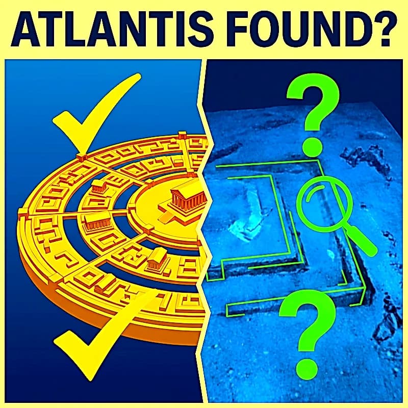
Atlantis was situated "opposite the strait which you call the Pillars of Hercules," corresponding to the modern Strait of Gibraltar. The capital city of Atlantis was a marvel of engineered concentric morphology. According to Critias, Poseidon carved a central hill, where his mortal lover Cleito lived, and surrounded it with alternating concentric rings of land and water.
To reconstruct the physical layout of the capital, the widths of these concentric zones must be calculated as radial increases and doubled to derive the overall diameter of the footprint.
Concentric Capital Dimensions (Greek Stadion ≈185 m)
| Concentric Zone Element | Radial Width (Stadia)::Contribution to Diameter (Stadia)::Metric Diameter |
|---|---|
| Central Island | —::5.0::0.93 km |
| Inner Water Ring | 1.0::2.0::1.30 km |
| Inner Land Ring | 2.0::4.0::2.04 km |
| Middle Water Ring | 2.0::4.0::2.78 km |
| Outer Land Ring | 3.0::6.0::3.89 km |
| Outer Water Ring | 3.0::6.0::5.00 km |
| Outer City Zone to Sea Wall | 50.0::100.0::23.50 km |
| Total Capital Footprint | —::127.0::23.50 km |
Plato also describes a massive canal dredged from the sea to the outermost water ring, measuring 50 stadia in length, allowing vessels to navigate into the inner harbors. Beyond the capital city lay a vast, rectangular, level plain measuring 3,000 by 2,000 stadia—roughly 560 by 370 kilometers, a scale comparable to the state of Nevada.
The July 2025 Bay of Cádiz Claims: Sonar, LiDAR, and the Doñana Precedent
In July 2025, during the Cosmic Summit conference, archaeologist and filmmaker Michael Donnellan presented data from a multi-year marine survey off the coast of the Bay of Cádiz, Spain. Donnellan's claims assert the discovery of the submerged capital of Atlantis directly outside the Pillars of Hercules.
His team utilized high-resolution side-scan sonar and LiDAR to map structures situated about 20 meters below the surface, claiming to discover definitive proof of Atlantis:
- Concentric Stone Walls: Three concentric circular walls carved into the seabed, with each standing 6 meters high.
- Megalithic Architecture: Carved channels, right angles, and massive rectangular blocks.
- Central Monument: A rectangular ruin at the center of the concentric structures.
- Seismological Damage: Scans showed that the outer wall had suffered severe tsunami damage, with inner walls cleanly split in two.
Scientific Skepticism and the Doñana Precedent
Despite the high-resolution sonar imagery, the academic community has maintained a highly cautious stance. This skepticism is deeply rooted in a major methodological error committed by the same research group. In November 2018, the team announced they had discovered Atlantis inland at Doñana National Park using satellite data. However, independent researchers quickly demonstrated that these "ancient concentric structures" were actually modern experimental ponds constructed in 2005 by Spanish biologists.
The 2018 Doñana Claim vs Reality
| Merlin Burrows & Donnellan's Claim | Scientific & Historical Reality |
|---|---|
| Prehistoric Concentric Towers/Rings | 96 elliptically-shaped temporary ponds built in 2005 for plankton research. |
| A 10,000-Year-Old Sea Wall | Modern earthen dikes associated with local agricultural land reclamation. |
| Oval Dimensions (250m, 125m, 60m) | Standardized experimental dimensions of the Donana Biological Station project. |
| Excavation Depths (30cm and 60cm) | Controlled depths of the 2005 biological research setup. |
Mainstream archaeologists suggest that any genuine stone walls mapped offshore at Cádiz are far more likely to be submerged Roman, Phoenician, or Carthagenian fish-processing facilities, salt pans, or natural beachrock formations.
The "Eye of the Sahara" (Richat Structure) Hypothesis
A highly popular alternative hypothesis locates the capital of Atlantis far inland, identifying it with the Richat Structure in Mauritania. Proponents point to its nested circular ring design and scale, arguing that its inner rings closely align with Plato's dimensions.
The international geological community completely rejects the anthropogenic origin of the Richat Structure. The IUGS officially designated it as one of the top 100 global geological heritage sites, celebrating it as a spectacular example of a magma-induced ring structure.
During the Cretaceous Period, a large alkaline igneous complex intruded from the mantle into the overlying sedimentary rock. This intrusion deformed the strata into a massive dome, which was subsequently eroded over tens of millions of years. Hard quartzite layers remained elevated as high-relief concentric circular ridges (cuestas), while softer rocks eroded into deep valleys.
Richat Structure vs Plato's Account
| Parameter | Plato's Atlantean Capital::Mauritania's Richat Structure::Geological Mismatch |
|---|---|
| Diameter of Concentric Core | 27 stadia (≈4.24 to 5.00 km)::≈40 km::The Richat Structure is nearly ten times larger than the concentric city described by Plato. |
| Elevation | Sea level (maritime island/estuary)::400 to 485 meters above sea level::The Adrar Plateau was never under marine water during the Holocene. A 400m marine transgression is impossible. |
| Archaeological Horizon | Advanced Bronze Age technology::Paleolithic Acheulean and Neolithic stone tools::There are no traces of permanent structures or metal smelting |
| only lithic scatters. | - |
| Canal Infrastructure | Huge dredged canal to the outer sea::Concentric valleys with no outlet channels::There is no geological evidence of artificial excavation or connection to the ocean. |
Evaluative Synthesis: The Feasibility of an Ice-Age Civilization
To bridge the chronological gap between the dawn of known civilizations and Plato's 9,600 BC timeline, alternative historians often invoke the Younger Dryas Impact Hypothesis (YDIH), suggesting a comet impact wiped out Atlantis and caused abrupt cooling. However, the YDIH remains highly contested and is widely considered refuted by mainstream science due to the lack of an identifiable crater and irreproducible markers.
The Geochemical Footprint: The Silurian Hypothesis
The most robust scientific argument against a lost, technologically advanced pre-ice age civilization is the total absence of its geochemical and industrial footprint. In 2018, scientists proposed the "Silurian Hypothesis," demonstrating that any advanced civilization would leave permanent, globally distributed geochemical markers, such as skewed carbon isotopes, synthetic plastics, radioactive fallout, and mineral depletion.
High-resolution environmental archives, such as deep-sea sediment cores and polar ice cores in Antarctica and Greenland, preserve an uninterrupted record of Earth's atmosphere spanning up to 800,000 years. As we look deeper into these archives—through the Younger Dryas—there is an absolute, pristine baseline of natural fluctuation. There are no anomalous spikes in lead, no synthetic chemicals, and no isotopic carbon shifts. The complete absence of these markers is definitive scientific proof that no such advanced civilization ever existed.
Rather than a global Ice Age empire, classical scholars and archaeologists generally believe that the Atlantis myth is a distant cultural memory of the Minoan civilization, which was devastated by the volcanic explosion of Thera around 1600 BC. Ultimately, Atlantis remains a brilliant, hypothetical construction of classical Greek philosophy, projected onto the natural wonders of the earth by modern seekers.